Map of the Alhambra Palaces, Gardens, Areas and Monuments Nearby
Here you will find various maps of the Alhambra, which not only display different views of the monumental complex and the locations of its various entrances, but also highlight points of tourist interest in the vicinity of the monument.3D Map of the Alhambra Buildings
This map displays the buildings of the Alhambra, along with the adjacent districts and streets, as well as the recommended routes at the camera's viewing angle set to 45 degrees.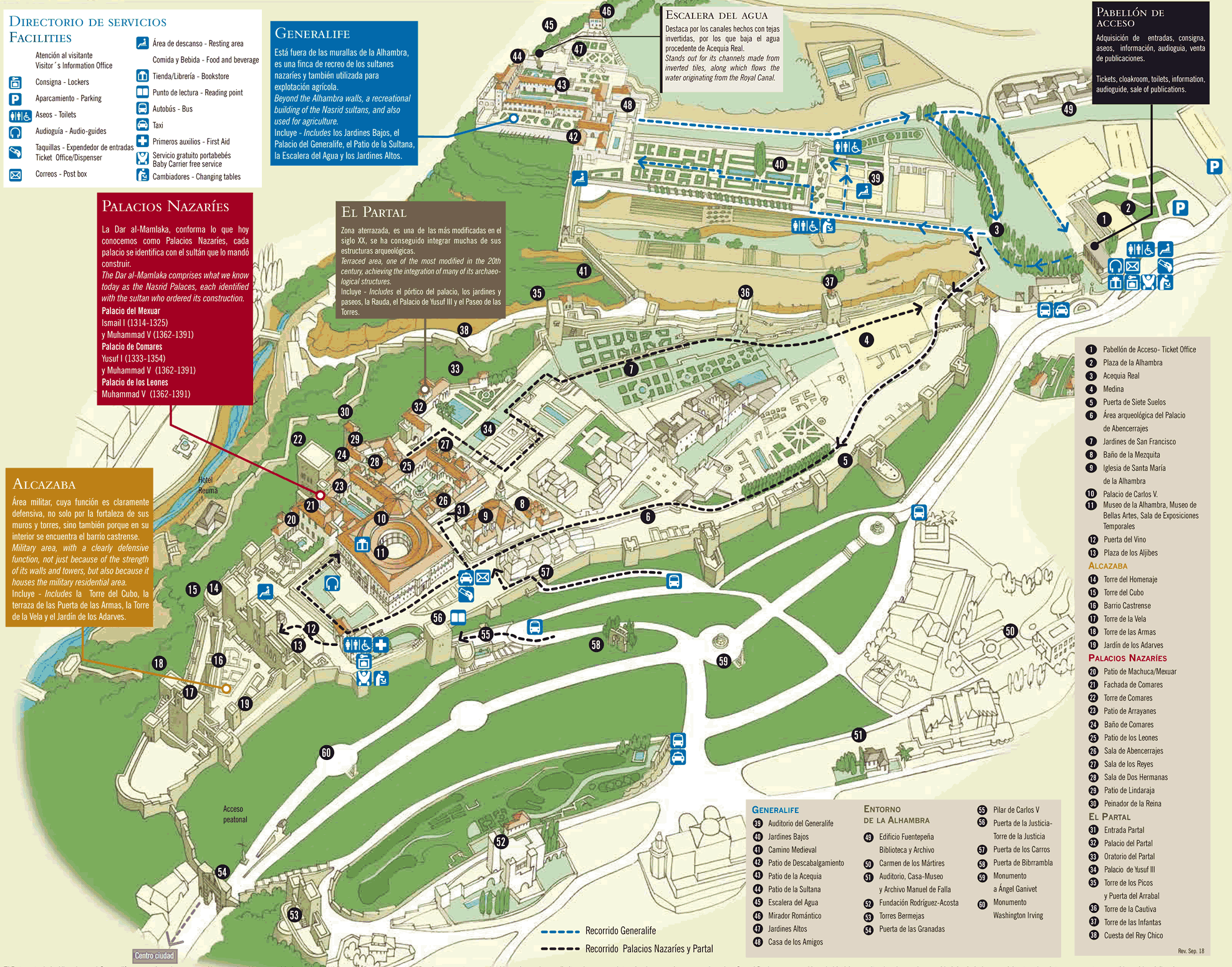
Enjoy a special day at the Alhambra with a guided tour
 Alhambra and Nasrid Palaces: discover the wonders of the Alhambra with this all-inclusive tour: the Nasrid Palaces, the Generalife, the Alcazaba, and more.
 Alhambra + Albaicín + Sacromonte: a perfect combination of a guided tour of the Alhambra in the morning and a guided tour of the Albaicin and Sacromonte in the afternoon.
Entrances, Restrooms, Drinking Fountains and Palaces of the Alhambra
A detailed map of the Alhambra showing all the main spots, like the Nasrid Palaces, Generalife Gardens, Alcazaba Fortress, and Partal. It also marks info points, drinking fountains, restrooms, parking, cafes, shops, viewing spots, and where to join a tour.
Model Representation of the Alhambra
This is the scale model representation of the Alhambra, providing a general view of its design and structure.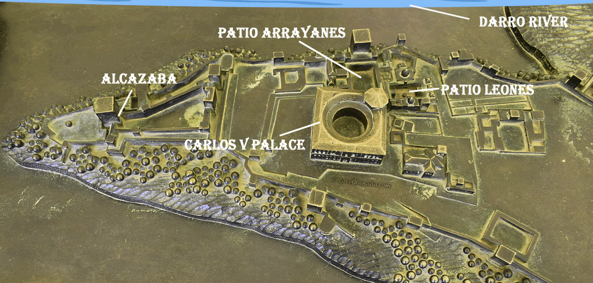
The Alhambra and Surroundings Map
A larger two-dimensional map shows the Alhambra palaces, along with the surroundings of the monument, including the historic neighborhoods of Albaycín and Realejo.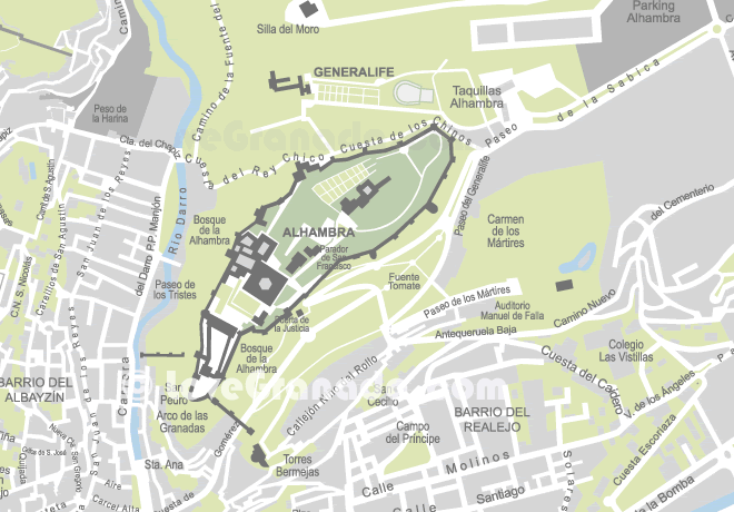
Here you can learn how the Alhambra is connected to the rest of the city. This information will assist you in planning your visit to both the Alhambra and other tourist attractions.
Map of the Main Areas of the Alhambra
A simple and user-friendly map showcasing the main areas and available services in the Alhambra, along with a suggested itinerary tailored for individuals with reduced mobility.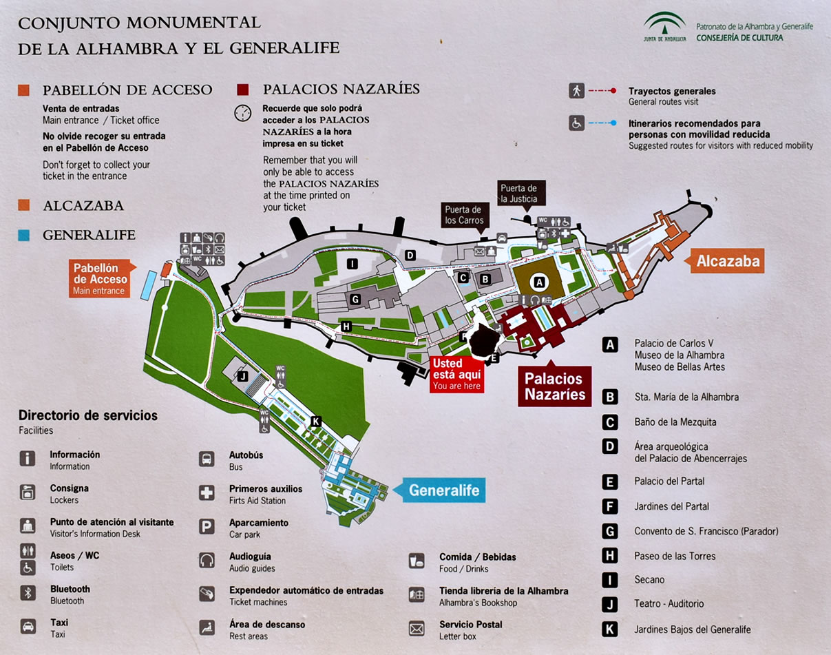
Where the Alhambra is Located in Granada
Google Maps provides a 2D map, satellite view, hybrid, and terrain map of the Alhambra.Page Updated: Mar 19, 2025
Was this useful? Been to these sights? Share your thoughts!
© Copyright •
LoveGranada.com • Any use of the content, including copying of it in whole or in part is prohibited.
You Might Also Be Interested In
Follow us on our social networks
If you find this information useful, please share it
Opinions about Alhambra Map
Public water points are not marked
Unfortunately that there are no public water points on the map, I know that there are several points in the Alhambra but they are not marked.
Relevant Information

The station, ski lessons, ski pass, parking, equipment rental, where to eat, how to get there and where to sleep.